Find Distances | LatLng Markers | Street View minimap
Google Maps Javascript API V3 Reference
https://developers.google.com/maps/documentation/javascript/reference
Official Getting Started Tutorial
http://code.google.com/apis/maps/documentation/javascript/tutorial.html
Google Geocoding API
http://code.google.com/apis/maps/documentation/javascript/geocoding.html
http://code.google.com/apis/maps/documentation/geocoding/
Geocoding strategies
https://developers.google.com/maps/articles/geocodestrat
Custom map types
https://developers.google.com/maps/documentation/javascript/maptypes#CustomMapTypes
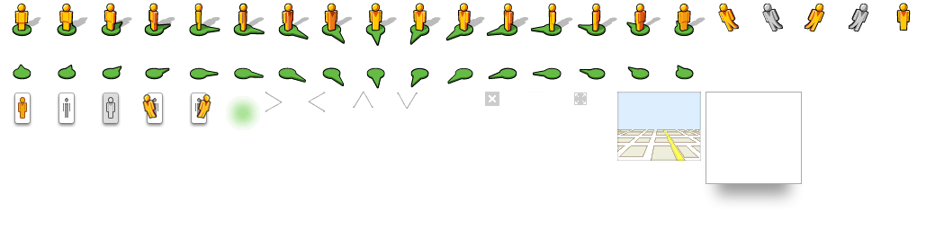
List of official marker icons
https://sites.google.com/site/gmapsdevelopment/
http://www.google.com/mapfiles/markerA.png
http://www.google.com/mapfiles/ms/micons/msmarker.shadow.png
http://maps.google.com/mapfiles/ms/micons/yellow-dot.png
Also, use Chrome Developer Tools > Frames > Images
Pegman sprite sheet
http://maps.gstatic.com/mapfiles/cb/mod_cb_scout/cb_scout_sprite_api_003.png
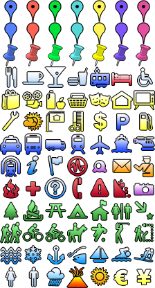
Hundreds of Map Icons
http://mapicons.nicolasmollet.com/
Natural Earth Data (for example, see admin_0_countries - 50m)
https://www.google.com/fusiontables/DataSource?docid=1UGwYogqtxVPga_76rxpL38CO1U6tr2s6Z0wSaQ
Google Maps API FAQ
http://code.google.com/apis/maps/faq.html
Documentation Examples
https://developers.google.com/maps/documentation/javascript/examples/?hl=en-EN
Drawing Manager with Shape delete
http://gmaps-samples-v3.googlecode.com/svn-history/r282/trunk/drawing/drawing-tools.html
KML Sample
http://maps.google.com/maps?f=q&hl=en&q=http%3A%2F%2Fkmlscribe.googlepages.com%2FSamplesInMaps.kml&ie=UTF8&ll=36.879621,-53.4375&spn=103.772916,208.476563&z=2&om=1
Spreadsheets to V2 Map
http://gmaps-samples.googlecode.com/svn/trunk/spreadsheetsmapwizard/makecustommap.htm
Google API Console
https://code.google.com/apis/console/
Static Maps API
http://code.google.com/apis/maps/documentation/staticmaps/
Google Geocharts
https://developers.google.com/chart/interactive/docs/gallery/geochart
Maps Services
https://developers.google.com/apps-script/service_maps
Lots of V3 examples
http://www.geocodezip.com/
http://www.wolfpil.de/
Marker manipulation
http://www.wolfpil.de/v3/toggle-cats.html
Charts Images Dynamic Icons (DEPRECATED)
http://code.google.com/apis/chart/infographics/docs/dynamic_icons.html
http://biostall.com/adding-number-or-letters-to-google-maps-api-markers
http://blog.mridey.com/2010/03/using-markerimage-in-maps-javascript.html
MarkerWithLabel
http://google-maps-utility-library-v3.googlecode.com/svn/tags/markerwithlabel/1.0.1/
Marker icons
http://maps.gstatic.com/intl/de_ALL/mapfiles/ms2/iconm.png
http://labs.google.com/ridefinder/images/mm_20_red.png
http://labs.google.com/ridefinder/images/mm_20_shadow.png
Utility Libraries V3
http://code.google.com/p/google-maps-utility-library-v3/wiki/Libraries
InfoBox
http://google-maps-utility-library-v3.googlecode.com/svn/trunk/infobox/
Styled Maps Wizard
http://gmaps-samples-v3.googlecode.com/svn/trunk/styledmaps/wizard/index.html
Contains over 60 display techniques, tests, and interactions (but V2)
http://econym.org.uk/gmap/
Sidebar examples
http://econym.org.uk/gmap/basic2.htm
https://files.nyu.edu/hc742/public/mapview.html
PHP/MySQL/Ajax
http://code.google.com/apis/maps/articles/phpsqlajax_v3.html
PHP/MySQL (V2)
https://developers.google.com/maps/articles/phpsqlsearch
https://developers.google.com/maps/articles/phpsqlajax
Spreadsheets
http://gmaps-samples.googlecode.com/svn/trunk/spreadsheetsmapwizard/makecustommap.htm
Fusion Tables - use new Date().getTime() with queries to stop auto-caching
http://code.google.com/apis/maps/documentation/javascript/layers.html#FusionTables
https://sites.google.com/site/fusiontablestalks/stories
Fusion Tables and Google Visualization and Custom Markers
http://code.google.com/p/gmaps-samples/source/browse/trunk/fusiontables/custom_markers.html
Fusion Tables and autocomplete
https://developers.google.com/fusiontables/docs/samples/autocomplete
Viewing a public Fusion Table (replace the id)
http://www.google.com/fusiontables/DataSource?dsrcid=641716
http://www.google.com/fusiontables/DataSource?dsrcid=825831 (see geometry column)
Fusion Tables heatmap
http://gmaps-samples-v3.googlecode.com/svn/trunk/fusiontables/beaches_heatmap.html
Map Builder from Fusion Tables
http://gmaps-samples.googlecode.com/svn/trunk/fusiontables/fusiontableslayer_builder.html
US Census boundary KML
http://www.census.gov/geo/www/tiger/index.html
KML Tutorial
https://developers.google.com/kml/documentation/kml_tut
Geometry formula (determinant) for distance map idea
http://stackoverflow.com/questions/907390/how-can-i-tell-if-a-point-belongs-to-a-certain-line
GENERAL
Place names to LatLng
http://www.geonames.org/
Is it possible to change the Google Maps Drawing manager icons?
ReplyDeleteThe below link i need to change custom icon. Please help me..........
Drawing Manager with Shape delete
http://gmaps-samples-v3.googlecode.com/svn-history/r282/trunk/drawing/drawing-tools.html
Nice Blog, The way you have explained about the things is very well and the suggestions are the best.
ReplyDeleteRead here what is Gstatic virus.